In partnership with the OGC, the FGDC, the U.S. Department of Homeland Security (DHS), and the U.S. Geological Survey (USGS) initiated a concept development study to gather information from national and global stakeholders through surveys, workshops, and interviews. The FGDC participated in national and international conferences and engaged a variety of disasters committees, executives, and stakeholders to encourage participation. The FGDC co-led two well-attended workshops with more than 200 representatives from over 80 organizations, including Federal, State, local, academic, commercial, international, and other non-governmental organizations. The resulting study identified key challenges, gaps, needs, lessons learned, best practices, and other information critical for crafting a strategy to advance the use of geospatial data and services in disaster response, including the following:

- The lack of an integrated policy and operational framework to facilitate rapid acceptance, qualification, ingestion, and use of relevant geospatial information from a range of government and commercial providers and citizens.
- The inability with existing metadata approaches to quickly discover and understand which information sources are most useful in the context of a user’s need, especially for first responders.
- The inability to properly fuse and synthesize multiple data sources locally to derive the knowledge necessary for rapid disaster-response decisions.
- The need for a persistent platform to organize and manage disaster-related geospatial information and tools necessary for collaborating organizations to address the full disaster lifecycle—preparedness, response, and recovery.

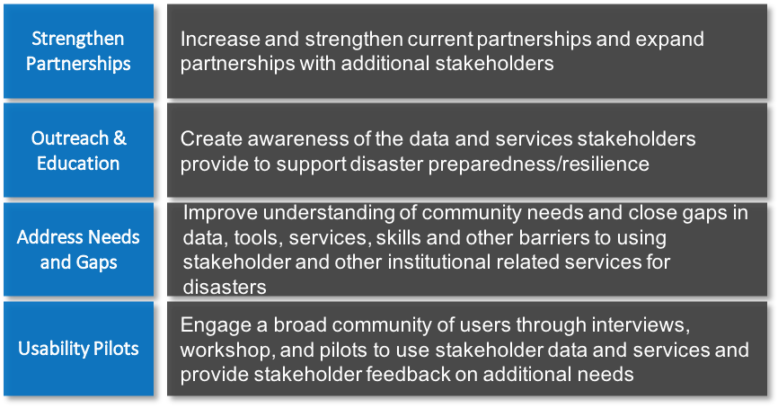
Over the next 5 years, the FGDC and other collaborators will engage the disasters community to address elements of the concept development study through workshops, pilots, and other initiatives. We will demonstrate how data standards help stakeholders and decision makers gain new and beneficial perspectives into social, economic, and environmental issues related to disasters by providing access to the vast online geospatial ecosystem of resources that improve the sharing, use, and integration of information tied to locations across the globe.
 For more information, contact
 –––––––––––––––––––––––
Eldrich FrazierEmail: fgdc@fgdc.gov