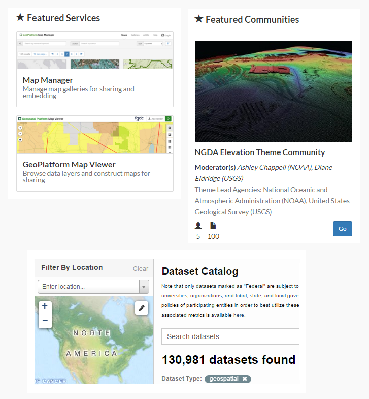
Geospatial Platform | Advancing Geographic Place-based Understanding through the GeoPlatform.gov
The FGDC coordinates the sharing of geographic data, maps, and online services through an online portal, GeoPlatform.gov. The Geospatial Platform (GeoPlatform) is a strategic national resource that supports requirements of the Geospatial Data Act of 2018, Administration's–Open Government, Open Data and Digital Government strategies to enhance transparency, collaboration and participation.
Government, industry, and individual citizens increasingly rely on information linked to location for planning, investment, and management activities. The ability to display information through interactive maps helps to communicate complex ideas more clearly and supports informed decision-making. Because geospatial information involves a significant investment of resources, many government agencies are coordinating their efforts to reduce costs, improve the quality of services, and increase efficiency.
The GeoPlatform provides a suite of well‐managed, highly available, and trusted geospatial data, services, and applications for use by Federal agencies—and their State, local, Tribal, and regional partners to meet their mission needs and the broader needs of the Nation. The GeoPlatform was developed by the member agencies of the FGDC through collaboration with partners and stakeholders. The GeoPlatform is being implemented to help agencies meet their mission needs, including communicating with and publishing data and maps to the public. The GeoPlatform focuses on web applications that facilitate participatory information sharing, interoperability, user‐centered design, and collaboration on the World Wide Web.
The GeoPlatform is a key component connecting many goals of the NSDI Strategic Plan in advancing the NSDI and GSDI. The portfolio of data, applications, and services provided on the GeoPlatform is stewarded through the use of open licenses and careful review and hosted on cloud infrastructure that maximizes geospatial interoperability. The GeoPlatform provides streamlined access to National Geospatial Data Assets and reduces data duplication. The collaborative GeoPlatform Marketplace helps reduce data acquisition costs. GeoPlatform's many tools and dashboards support the A-16 Portfolio Management process.
The Geospatial Platform functions as the service and delivery mechanism for the Federal portfolio of geospatial data, services, and applications, and as the integration point for the discovery, access, and joint use of Federal and non-Federal geospatial data and services. Data of the highest value, reliability, and accuracy are found at the agencies where they are created and managed, whether a Federal, State, Tribal, regional, local, or nongovernmental organization. Providing timely and efficient discovery, access, and use of this data is the core mission of the Geospatial Platform.
What is the Geospatial Platform?
The Geospatial Platform will be an Internet-based capability providing shared and trusted geospatial data, services, and applications for use by government agencies and partners to meet their mission needs and by the public.
What is the Purpose of the Geospatial Platform?
The Geospatial Platform will function as the service and delivery mechanism for the Federal portfolio of geospatial data, services, and applications, and as the integration point for the discovery, access, and joint use of Federal and non-Federal geospatial data and services. What Will the Geospatial Platform Offer? The Geospatial Platform will offer access to trusted geospatial data, services, and applications maintained in the Federal Geospatial Portfolio to support government agencies in meeting their mission objectives, and provide efficiencies and cost savings through shared infrastructure and enterprise solutions. The Geospatial Platform will provide:
- A “one-stop shop” to deliver trusted, nationally consistent data and services.
- Tools for the centralized discovery, access, and use of data and services managed and maintained in multiple agencies, locations, and levels of government.
- Tools that enable data to be displayed in a visual context - a fundamental way in which humans process information.
- Problem-solving applications that are built once and reused many times across multiple Federal agencies and other organizations.
- Services based upon common, secure, and scalable open-standards, ensuring interoperability between components.
- A shared cloud computing infrastructure to cost-effectively host data and applications, and handle increased service demands quickly without additional hardware investments. Shared geospatial capabilities (hosting, services, analytical tools, etc.) for Federal agencies that do not have the financial or human resources to leverage geospatial tools to help them fulfill their mission requirements with little or no additional cost.
- Shared geospatial capabilities (hosting, services, analytical tools, etc.) for Federal agencies that do not have the financial or human resources to leverage geospatial tools to help them fulfill their mission requirements with little or no additional cost.
- A set of user-friendly tools to support key initiatives such as the Administration’s Open Government Initiative and Place-Based Policies Initiative.
- The tools and infrastructure to enable decision makers to quickly and efficiently determine what geospatial data, services, and application assets can be brought to bear to address priorities, solve problems, and identify solutions.
- The means to implement the Federal Geospatial Portfolio Management processes described in the November 2010 Office of Management and Budget (OMB) Circular A-16 Supplemental Guidance.
-
The opportunity to leverage complementary efforts such as Data.gov and the Federal cloud computing initiative.
Additional Information
- Frequently Asked Questions
- Building the Business Case for the Geospatial Platform : The Value Proposition
For more information, contact
–––––––––––––––––––––––
Roxanne Lamb
Email: rhlamb [at] fgdc.gov or fgdc@fgdc.gov

Geospatial Platform Services
GeoPlatform Service Catalog- Data Services - The GeoPlatform delivers trusted, nationally consistent, authoritative geographically enriched social, economic, environmental and other data for understanding and decision making.
- Applications and Tools - The GeoPlatform provides a suite of applications and tools for integrating, synthesizing, analyzing, problem-solving and visualizing geographically enriched data to accelerate understanding and decision-making.
- Shared Services - The GeoPlatform provides shared hosting infrastructure that allows agencies to publish their geospatial data, applications, and tools in a secure cloud-computing environment at a low cost.

