| When |
May 24, 2017
from 07:30 AM to 03:30 PM |
|---|---|
| Where | USGS Headquarters, Reston, VA |
| Contact Name | Jennifer Carlino |
| Contact Phone | 303.202.4260 |
| Add event to calendar |
|
 The FGDC hosted a 2017 International Organization for Standardization
(ISO) Metadata Summit on May 24, 2017 at USGS Headquarters in Reston Virginia. The purpose of the Summit was to improve geospatial data and services discovery and use for federal and non-federal National Spatial Data Infrastructure (NSDI) stakeholders and users. Attendees participated in presentation and breakout sessions to share best practices and develop recommendations for the implementation of the ISO geospatial metadata content standard. The Summit will build upon the previous FGDC sponsored Metadata Workshops and focus on:
- Identifying and addressing ISO metadata implementation issues
- Developing ISO metadata implementation plans
- Leveraging the Geospatial Platform to implement the standard and access services
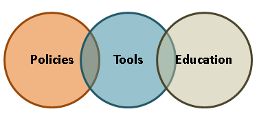
- Engaging participation in ISO metadata policies, tools, and, outreach
- Sustaining implementation efforts
Summit Materials
- Summary Report (pdf)
- Agenda (pdf)
- Presentation Descriptions (pdf)
-
Breakout Descriptions (pdf)
-
Breakout Handout (doc)
- Presentations
- Building On Our Progress (pdf) & Webex Recording (mp4)
- Leveraging The Geospatial Platform (pdf) & Webex Recording (mp4)
- ISO Standards Update (pdf) & Webex Recording (mp4)
- Publishing ISO Metadata to Data.gov (pdf) & Webex Recording (mp4)
- Benefits of Documenting Geospatial Data and Services (pdf) & Webex Recording (mp4)
- ISO 19115-1 Transition: Policy and Planning (pdf) & Webex Recording (mp4)
- North Carolina State and Local Government Metadata Profile (pdf) & Webex Recording (mp4)
- Why, How and What of the EPA Metadata Editor 5.0 (pdf) & Webex Recording (mp4)
ISO Tools Session: Tuesday, May 23, 2017
An optional ISO Metadata Tools Session will be held one day prior to the Summit on Tuesday, May 23, 2017 at the USGS Headquarters Building in Reston, Virginia. The session will provide an overview and hands on demonstration of tools including the Geospatial Platform application and others such as the EPA ISO Metadata Editor. Attendance to the ISO Tools Session is limited to 30 participants and pre-registration is required. Remote access will be available.
- Agenda (pdf)
- Presentation Descriptions (pdf)
- Presentations
- Geospatial Platform (pdf) & Webex Recording (mp4)
- Esri Geoportal Server (pdf) & Webex Recording (mp4)
- EPA Metadata Editor (EME 5.0) (pdf) & Webex Recording (mp4)
- NASA Metadata Management Tool (MMT) (pdf) & Webex Recording (mp4)
- NOAA Metadata Rubric (pdf) & Webex Recording (mp4)
- Alaska Consortium ISO Metadata Toolkit (pdf) & Webex Recording (mp4)
For more information or to register for either event, contact Jennifer Carlino, FGDC, isometadatasummit@fgdc.gov.

