News | NGAC

Interior Department Appoints New Members and Leadership to National Geospatial Advisory Committee

February 26, 2016

Secretary of the Interior Sally Jewell has appointed a new Chair and Vice Chair and 14 new and continuing members to the National Geospatial Advisory Committee (NGAC), which provides recommendations to the Federal Geographic Data Committee (FGDC), the interagency executive group responsible for providing leadership and direction in federal geospatial programs. 

Julie Sweetkind-Singer, the new NGAC Chair, is a leader in the geospatial library and information management community, serving as the Assistant Director of Geospatial, Cartographic and Scientific Data; and Head Librarian of the Branner Earth Sciences Library and Map Collections at Stanford University. Sweetkind-Singer has served as NGAC Vice-Chair for the past year.

Keith Masback, the new vice-chair, serves as the Chief Executive Officer of the U.S. Geospatial Intelligence Foundation. Before serving in this role, he was an officer in the U.S. Army and a senior executive in the National Geospatial-Intelligence Agency. 

"We are honored to have these accomplished geospatial professionals as leaders and members of the National Geospatial Advisory Committee,” said Jennifer Gimbel, Principal Deputy Assistant Secretary of the Interior for Water and Science, who serves as Chair of the FGDC Steering Committee. “The NGAC has been a valuable resource and an excellent partner for the Federal geospatial community, and has provided thoughtful advice and recommendations on a wide range of geospatial policy and management issues. Geospatial data and technology are essential for Federal agencies and we look forward to continuing our collaboration with this distinguished set of leaders.” 

The NGAC includes up to 30 members, selected to achieve a balanced representation of the varied interests associated with geospatial programs and technology. NGAC members are appointed to serve staggered terms on the committee. The appointees to three-year terms on the NGAC are: 

  • Mr. David Alexander, Department of Homeland Security 
  • Mr. Frank Avila, National Geospatial-Intelligence Agency 
  • Dr. Sarah Battersby, Tableau Software 
  • Mr. Talbot Brooks, Delta State University (reappointed to a second term)
  • Mr. Matt Gentile, Deloitte Financial Advisory Services (reappointed to a second term) 
  • Mr. Frank Harjo, Muscogee (Creek) Nation (reappointed to a second term) 
  • Mr. Xavier Irias, East Bay Municipal Utility District
  • Mr. Roger Mitchell, MDA Information Systems, Inc. (reappointed to a second term) 
  • Ms. Rebecca Moore, Google, Inc. 
  • Dr. Laxmi Ramasubramanian, Hunter College, City University of New York 
  • Dr. Carl Reed, Carl Reed and Associates, LLC 
  • Ms. Amber Reynolds, City of Topeka, Kansas 
  • Dr. Douglas Richardson, American Association of Geographers (reappointed to a second term) 
  • Dr. May Yuan, University of Texas – Dallas 

The NGAC meets three to four times per year. The public is invited to comment and make suggestions at all committee meetings, which will be announced by publication in the Federal Register at least 15 days before the meeting date. The U.S. Geological Survey, a bureau of the Department of the Interior, provides support services for the NGAC. The NGAC functions solely as an advisory body. 

The NGAC was created under the Federal Advisory Committee Act, enacted by Congress in 1972 to ensure that advice rendered to the executive branch by advisory committees, task forces, boards, and commissions formed by Congress and the President, be both objective and accessible to the public. The Act formalized a process for establishing, operating, overseeing, and terminating these advisory bodies. 

Additional information about the NGAC, including a complete list of the committee members, is available at www.fgdc.gov/ngac.

Download the PDF version of the release.

Interior Department Appoints New Members and Leadership to National Geospatial Advisory Committee - Read More

ngac news release new appointments feb 2016

ngac news release new appointments feb 2016 - Read More

NGAC News

NGAC News - Read More

doi appoints 14 members to ngac jan 2017

doi appoints 14 members to ngac jan 2017 - Read More
Department of the Interior Appoints 14 Members to National Geospatial Advisory Committee

Department of the Interior Appoints 14 Members to National Geospatial Advisory Committee

January 9, 2017

The Department of the Interior has appointed 14 individuals to serve as members of the National Geospatial Advisory Committee (NGAC), which provides advice and recommendations on federal geospatial policy and management issues and the development of the National Spatial Data Infrastructure (NSDI). The NSDI promotes sharing of geospatial data across all levels of government, the private and non-profit sectors, and the academic community.

The Department has also reappointed the Chair and Vice-Chair of the NGAC. Julie Sweetkind-Singer, the NGAC Chair, is the Assistant Director of Geospatial and Cartographic Services; and Head Librarian of the Branner Earth Sciences Library & Map Collections at Stanford University.  Keith Masback, the NGAC Vice-Chair, serves as the Chief Executive Officer of the U.S. Geospatial Intelligence Foundation.

The NGAC includes up to 30 members, selected to achieve a balanced representation of the varied interests associated with geospatial programs and technology. NGAC members are appointed to serve staggered terms on the committee. The 2017 appointees to three-year terms on the NGAC are:

  • Mr. Gar Clarke, State of New Mexico
  • Mr. Garet Couch, National Tribal Geographic Information Support Center
  • Ms. Patricia Cummens, ESRI (reappointed to a second term)
  • Mr. Stuart Davis, State of Ohio
  • Ms. Roberta Lenczowski, Roberta E. Lenczowski Consulting
  • Mr. Keith Masback, U. S. Geospatial Intelligence Foundation (reappointed to a second term)
  • Mr. Kevin Pomfret, Centre for Spatial Law and Policy (reappointed to a second term)
  • Major General William N. Reddel III, New Hampshire National Guard (reappointed to a second term)
  • Ms. Rebecca Somers, Somers-St. Claire GIS Management Consultants
  • Mr. Cy Smith, State of Oregon
  • Ms. Jennie Stapp, State of Montana
  • Ms. Julie Sweetkind-Singer, Stanford University (reappointed to a second term)
  • Dr. Harvey Thorleifson, State of Minnesota (reappointed to a second term)
  • Mr. Jason Warzinik, Boone County, Missouri (reappointed to a second term)

The NGAC meets three to four times per year. The public is invited to comment and make suggestions at all committee meetings, which will be announced by publication in the Federal Register at least 15 days before the meeting date. The U.S. Geological Survey, a bureau of the Department of the Interior, provides support services for the NGAC. The NGAC functions solely as an advisory body.

The NGAC was created under the Federal Advisory Committee Act, enacted by Congress in 1972 to ensure that advice rendered to the executive branch by advisory committees, task forces, boards, and commissions formed by Congress and the President, be both objective and accessible to the public. The Act formalized a process for establishing, operating, overseeing, and terminating these advisory bodies.

Additional information about the NGAC, including a complete list of the 28 committee members, is available at www.fgdc.gov/ngac.

Related Items


Department of the Interior Appoints 14 Members to National Geospatial Advisory Committee - Read More

New NGAC paper: Geospatial Information - The Key to Smart Infrastructure Investments

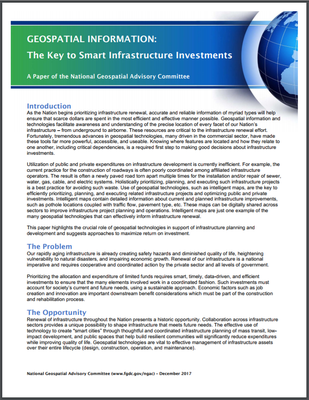
ngac paper geospatial key to smart investments coverThe National Geospatial Advisory Committee (NGAC) has adopted a paper highlighting the critical role geospatial tools and information can play in supporting national infrastructure development initiatives.  The paper, “Geospatial Information: The Key to Smart Infrastructure Investments,” focuses on the unique ability of geospatial technology to enable smart infrastructure decisions and investments, and describes how geospatial tools can be used to plan, manage, and communicate the results of national infrastructure development initiatives. 

The paper notes that all levels of government and private entities have a role to play in using geospatial technologies to enhance the efficiency of infrastructure renewal. The NGAC recommends that the Federal government’s role should include:

  1. Supporting foundational data such as remotely sensed imagery, address data, and other National Geospatial Data Assets.
  2. Promoting data sharing standards to reduce duplicated effort and enhance data sharing.
  3. Utilizing geospatial data and tools, including the GeoPlatform (www.geoplatform.gov), to plan, manage, track, and communicate the results of a national infrastructure initiative.
  4. Ensuring that infrastructure grant funds may be applied to geospatial data, systems, and services. Such investments are as important as investments in steel and concrete, but with a far greater return.
  5. Modernizing governance of geospatial data and programs nationally to reduce duplication and capture increased efficiencies.

The NGAC is a Federal Advisory Committee that provides advice and recommendation on national geospatial policy issues to the member agencies of the Federal Geographic Data Committee.  The NGAC includes members from all levels of government, the private sector, non-profits, and academia.  Additional information about the NGAC is available at: www.fgdc.gov/ngac.

New NGAC paper: Geospatial Information - The Key to Smart Infrastructure Investments - Read More
ngac paper geospatial key to smart investments cover

ngac paper geospatial key to smart investments cover

ngac paper geospatial key to smart investments cover - Read More
FGDC Seeks Nominations for National Geospatial Advisory Committee

FGDC Seeks Nominations for National Geospatial Advisory Committee

July 8, 2024

The Department of the Interior and the Federal Geographic Data Committee (FGDC) are seeking nominations to serve on the National Geospatial Advisory Committee (NGAC). The NGAC provides advice and recommendations relating to the management of Federal and national geospatial programs, the development of the National Spatial Data Infrastructure, and implementation of the Geospatial Data Act of 2018 (GDA), to the Secretary of the Interior through the FGDC. The NGAC provides a forum for views of non-Federal stakeholders in the geospatial community. The NGAC is a Federal Advisory Committee authorized through the GDA which operates in accordance with the Federal Advisory Committee Act (FACA).

Nominations to participate on this Committee must be received by August 7, 2024 and should be submitted electronically to . Nominations may come from employers, associations, professional organizations, or other geospatial organizations. Nominations should include a resume providing an adequate description of the nominee’s qualifications, including information that would enable the Department of the Interior to make an informed decision regarding meeting the membership requirements of the Committee and permit DOI to contact a potential member.  Nominees are strongly encouraged to include supporting letters from employers, associations, professional organizations, and/or other organizations that indicate the support by a meaningful constituency for the nominee. 

The NGAC includes up to 30 members, selected to generally achieve a balanced representation of the viewpoints of the various stakeholders involved in national geospatial activities. NGAC members are appointed for staggered terms, and nominations received through this call for nominations may be used to fill vacancies on the NGAC that will become available in 2025 and 2026. Nominations will be reviewed by the FGDC and additional information may be requested from nominees. Final selection and appointment of NGAC members will be made by the Secretary of the Interior.

The NGAC meets approximately 3-4 times per year. NGAC members will serve without compensation, but travel and per diem costs will be provided by the U.S. Geological Survey. Committee meetings are open to the public. Notice of committee meetings are published in the Federal Register at least 15 days before the date of the meeting. The public will have an opportunity to provide input at these meetings.

The NGAC Charter includes additional information about the NGAC’s roles and responsibilities.

Resources

Contact

For additional information or questions, please contact .

FGDC Seeks Nominations for National Geospatial Advisory Committee - Read More

fgdc announcement 2024 ngac nominations

fgdc announcement 2024 ngac nominations - Read More

frn ngac nominations 2024

frn ngac nominations 2024 - Read More

National Geospatial Advisory Committee Nominations Informational Webinar

National Geospatial Advisory Committee Nominations Informational Webinar

National Geospatial Advisory Committee Nominations Informational Webinar - Read More