NSDI | Development of National Spatial Data Infrastructure Partnerships
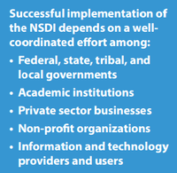
 Since 1994, the FGDC has provided leadership in fostering collaboration and developing partnerships for the advancement of the NSDI. An effective NSDI requires developing and utilizing partnerships that promote collaboration, cost-effectiveness, and interoperable solutions. These components are the key underpinnings of the NSDI. Moreover, federal geospatial programs are highly dependent on effective relationships with partners and stakeholders from multiple sectors, including the private sector, academia, nonprofits, and all levels of government.
An effective NSDI requires developing and utilizing partnerships that promote collaboration, cost-effectiveness, and interoperable solutions. These components are the key underpinnings of the NSDI.
The FGDC works collaboratively with federal, state, tribal, and local governments, non-Federal partners, communities, constituents, and professional bodies providing the enabling foundation of standards, data catalogs, partnerships, and tools that make up the NSDI.
Introduction
Many organizations throughout the United States have a stake in building the National Spatial Data Infrastructure (NSDI) together. The FGDC welcomes participation by state, local, and tribal governments, the academic community, and the private and non-profit sectors in building the NSDI. Non-federal organizations may serve as Collaborating Partners by requesting official stakeholder status in writing to the Chair of the FGDC. Collaborating Partners are encouraged to participate on subcommittees and working groups and provide input into all decisions. Voting privileges are not extended to Collaborating Partners.
-
Federal - At the federal level, FGDC enables coordination among the federal agencies through the Steering Committee, Coordination Group, and its working groups and subcommittees. Learn more about the FGDC organization and how each component of the organization works collaboratively towards the advancement of the NSDI.
-
State and Local Government - The FGDC works with state representatives to enable the coordination, collection, documentation, discovery, distribution, exchange and maintenance of geospatial information in support of the NSDI.
Related Projects, Initiatives and Activities | 50 States Initiative | State NSDI Plans | NSGIC Member |
-
Partners - One of the primary ways that the FGDC collaborates with its broad network of partners is through the National Geospatial Advisory Committee (NGAC). The Department of the Interior (DOI) established the NGAC in 2008 as a means to improve the coordination and governance of national geospatial activities. The NGAC provides advice and recommendations to the FGDC and provides a forum to convey views representative of partners in the geospatial community. The FGDC also has many official collaborating partners.
Additional Information | NSDI Partner Information | NSDI Cooperative Agreement Program |
-
International - The FGDC supports international Spatial Data Infrastructure (SDI) development. Circular A-16 encourages the FGDC to participate in building the Global Spatial Data Infrastructure (GSDI) in addition to building the National Spatial Data Infrastructure (NSDI). FGDC is actively engaged with Group on Earth Observations (GEO) & Global Earth Observations System of Systems (GEOSS) and United Nations Committee of Experts on Global Geospatial Information Management (UN-GGIM). Learn more about FGDC’s international activities.
FGDC Activities | UN-GGIM | UN-GGIM Americas | GEO | AmeriGEO Platform |
-
Regional and Global SDI activities make good business sense while they contribute to good governance. In this way, FGDC ensures that the policies, procedures, standards, metadata, and related components that are developed within the U.S. are compatible with our neighbors’ as well as globally. The rationale for sharing geospatial information across city, county, and state boundaries applies to sharing across international boundaries as well. Watershed, ecosystem, and related boundaries do not stop at political borders. Moreover disasters, famine, poverty, diseases, and similar human issues do not stop at international boundaries. Global SDI’s can help alleviate these problems by providing geospatial information and related services.